That Phrase About the 'Wrong Side of the Tracks' Was Never Just a Figure of Speech
Most Americans use the phrase without thinking twice. You say someone grew up on the wrong side of the tracks, and everyone knows what you mean — a rougher part of town, a lower-income neighborhood, a place that carries a certain stigma. It feels like a colorful bit of folk language, the kind of expression that drifted into common use from some vague cultural memory.
Except it wasn't vague at all. It was literal. And the economic logic behind it was deliberate, durable, and far more systematic than most people realize.
Why Railroads Didn't Just Divide Towns — They Sorted Them
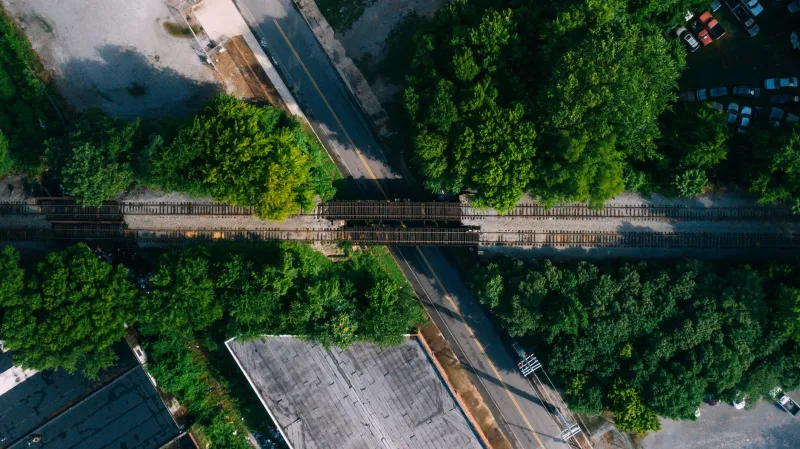
When railroads expanded across the United States in the mid-to-late 1800s, they didn't just connect cities. They cut directly through them. And where a rail line ran through a town, it created an immediate spatial division that developers, planners, and lenders quickly learned to exploit.
The key factor wasn't the tracks themselves — it was what the tracks brought with them. Industrial facilities, freight yards, warehouses, and manufacturing plants all clustered near rail lines because that's where the logistics made sense. And those facilities came with noise, soot, smoke, and chemical runoff that made nearby land less desirable for residential living.
But here's the detail that most people miss: the industrial pollution didn't distribute evenly on both sides of the tracks. It followed the wind.
In most of the continental United States, prevailing winds blow from west to east. That meant the smoke, particulate matter, and industrial odors from rail-adjacent facilities drifted eastward. The east side of the tracks — the downwind side — absorbed the worst of it. The west side stayed comparatively cleaner. Developers noticed. Lenders noticed. And over time, that environmental reality hardened into a pricing system.
Wealthier residents and higher-end residential development clustered on the upwind side. Lower-income housing, worker tenements, and industrial-adjacent land ended up on the other. The phrase 'wrong side of the tracks' wasn't describing a social attitude — it was describing a documented economic gradient that had a meteorological explanation.
How the Gap Became Permanent
The wind-and-soot dynamic was the original driver, but it didn't stay the only one. Once a neighborhood's position relative to the tracks became associated with a particular income level or demographic group, other forces moved in to reinforce it.
Zoning decisions followed the existing pattern. Industrial and commercial uses got concentrated on the already-depressed side of the line, which further reduced its residential appeal. Mortgage lenders used neighborhood location as a proxy for loan risk — a practice that eventually formalized into the redlining maps produced by the federal Home Owners' Loan Corporation in the 1930s. Many of those maps drew their boundaries with railroad lines as reference points.
Local tax bases diverged. Property values on the less desirable side generated less revenue, which meant lower investment in schools, infrastructure, and public services — which made the neighborhood less desirable, which kept values lower. The feedback loop ran for decades.
By the time diesel replaced steam and most freight rail declined in the mid-20th century, the original source of the disparity — the actual smoke and industrial activity — had largely disappeared. But the pricing gap it created had already been baked into zoning maps, lending policies, and neighborhood reputations. The tracks were gone or dormant in many places, and the economic divide they'd created remained essentially intact.
What This Looks Like in American Cities Today
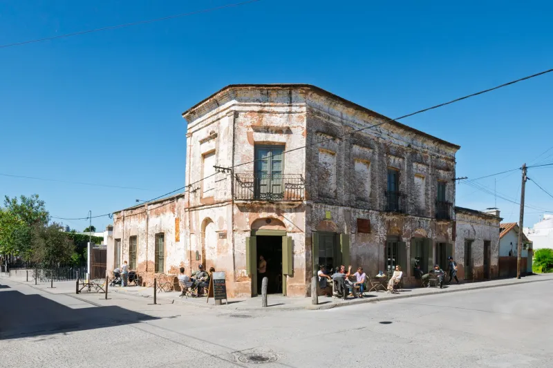
If you want to see this dynamic in action, you don't have to look at historical maps. You can look at current property values in almost any mid-sized American city that grew up around rail infrastructure.
In city after city, the neighborhoods that developed on the historically downwind, industrially adjacent side of old rail corridors still carry lower average home prices, higher poverty rates, and lower access to amenities than their counterparts on the other side. This isn't universal — urban renewal, gentrification, and geographic quirks have scrambled the pattern in some places — but it's consistent enough that researchers studying urban economic geography treat rail line placement as a meaningful predictor of present-day neighborhood outcomes.
Some of those old rail corridors have been converted into greenways, bike paths, and linear parks. Cities have tried to use those conversions as catalysts for neighborhood revitalization. Sometimes it works. Sometimes the pricing gap proves more stubborn than the infrastructure project that was supposed to close it.
Why the Myth Version Is More Comfortable Than the Real Story
There's a reason most people prefer the folk-saying interpretation to the actual history. The metaphor version suggests that neighborhood hierarchies are organic — a natural sorting of people by ambition, values, or circumstance. The real version suggests something more deliberate: that the physical layout of American cities was shaped by industrial economics, environmental factors, and lending policy in ways that created durable inequalities with specific, traceable causes.
That's a harder story to sit with. It means the price differential between two neighborhoods a quarter-mile apart isn't just 'the market' doing its thing — it's the accumulated result of decisions made by railroad companies, industrial planners, federal lending agencies, and local zoning boards over more than a century.
The Takeaway
Next time you hear someone describe a neighborhood as being on the wrong side of the tracks, know that the phrase has a real engineering history behind it — one involving prevailing winds, industrial siting decisions, and federal mortgage policy. The tracks in most American cities are long gone or dormant. The economic boundaries they drew are considerably harder to erase.